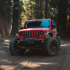
4x4tographer 3,670 Posted October 11, 2021 (edited) Some photos from a 13 hour exploratory run on Sunday (10/10). We attempted to find (and were successful!) the townsite of Packer, an old ranching camp, which is tucked away deep in the Bradshaw Mountains. @johnpa & @theksmith were excellent company, as always! We started the day out at one of the Table Mesa staging areas, hoping to form a loop up through the Bradshaws to Packer, then southwest towards Lake Pleasant or the Crown King Trail. The views were, frankly, stunning. Some of the best I've seen along all of the trails along the entire I-17 corridor. You could tell that the trail is almost never run. We didn't encounter another vehicle on the trail all day, and there were zero signs of tire tracks in the dirt. The trail conditions ranged from "Typical Table Mesa" to narrow shelf, rocky/bouldery to rough/bumpy, grassy 2 track to recently bladed. There were multiple wash crossings and many, many, many mountain passes. The trail was a heavy moderate to difficult in some areas with some ledge obstacles, boulder crawling, and some narrow shelf sections with fallen boulders. A few spots were needed in the shelf+boulder areas due to lack of visibility. Along the way we found some pretty well preserved ruins, several windmills, and panoramic vistas. Black Canyon City is in at the base of the canyon in this image. There wasn't a lot of space to turn around, so you really need to commit, especially along the shelf roads. We did find a few clearings where there was enough space for 2-3 rigs to park/turn/camp, but little-no shade. Our lunch spot was insanely gorgeous - you had sweeping southerly views of Black Canyon, Table Mesa, all the way to Lake Pleasant. Here's a windmill and coral we found along the way. Here's a video of the windmill in action (video). Here are some photos of the Packer townsite. The set up was interesting - the site itself was on a spring, down in a sort of box canyon. There were a ton of lush trees, green grass, and the breeze and temps were cool. Pretty ideal place for Arizona! If you look closely in the following image, you can see something very large died in that shed. Just above Willow Creek on the way to Packer we discovered that Arizona has its very own Monolith. This rock was approximately 2x the size of a full size pick-up and was somehow, impossibly, standing on edge in what was an absolute freak of nature. Unfortunately, our idea to form a loop didn't quite go as planned. We ran into a rancher that is denying passthrough access due to vandalism that has occured on their property. They noted that folks have been shooting at their building, solar powered water pumps, and even cattle. We ended up needing to back track about 4-5 hours as there are no alternate routes out of the area. As frustrating as it was, this is an excellent example of "the few ruining it for all". On the way back, some cows decided to slow things down a bit (video). We made pretty quick work on the way back, getting a great second look at the trail from the reverse direction. We stopped again in the canyon above Boulder Creek just as the sun set and the moon rose. Edited October 12, 2021 by 4x4tographer 3 1 2 Share this post Link to post Share on other sites
shellback91 2,332 Posted October 12, 2021 Your pics did not come through from what I am seeing. Should I just use my imagination? 😂 1 1 Share this post Link to post Share on other sites
theksmith 5,893 Posted October 12, 2021 (edited) i'm sure he'll get those photos showing up soon... thanks for taking the time to document our exploration @4x4tographer! great trail - but LONG, rough, and BRUSHY - some of the new gouges i got are down into the primer! nice to have you along for the crazy ride @johnpa. Edited October 12, 2021 by theksmith 5 Share this post Link to post Share on other sites
4x4tographer 3,670 Posted October 12, 2021 48 minutes ago, shellback91 said: Your pics did not come through from what I am seeing. Should I just use my imagination? 😂 Whooooops! 😅 Fixed it! 1 Share this post Link to post Share on other sites
theksmith 5,893 Posted October 12, 2021 (edited) some background for those interested... Boulder Creek Ranch owns a tiny little square of property which cuts off all trail access to the "back side" of the Tip Top Mine ruins. they also have an agreement with the folks that own the mine to have a large metal gate on their property which cuts off access from the "front side". the ranch has grazing rights on a bunch of the surrounding public land and supposedly they nixed access because of vandalism. though i sympathize with their plight, i'm still not OK with them effectively blocking OHV access to hundreds of acres of BLM and State trust land by closing a route that has existed since well before my time on the Earth. back in 2016 a small group of us ran from Table Mesa to Tip Top Mine, then eventually found our way over to Lake Pleasant. the metal gate before Tip Top Mine was either non-existent at that time (or open and we didn't even notice it), and no-one was at the old shack owned by Boulder Creek Ranch. there were signs saying we were being recorded by trail cams, but no signs or anything barring access to the trails that ran beside the shack. Here's the 2016 trip report... then in 2019 another group of us tried a slightly different (and backwards) version of the route. that time we ran into a worker at the old shack who wouldn't let us through. i also noticed they had been busy upgrading many of the fences in the area. we did find an extremely brushy alternate route over to Tip Top Mine which bypassed that Boulder Creek Ranch property. however, we still ended up behind the new locked metal gate at Tip Top Mine. The 2019 trip report... cut to last weekend (2021) - we wanted to visit Packer - which was just a name and dot on a map along with some shacks in satellite photos as far as we could find. however, our secondary goal was to evaluate the trail as a potential way to get to the lake again from Table Mesa since it would bypass the entire gated Tip Top Mine area. it was an extremely long semi-circle route that heads North just a bit before Tip Top and then heads back South toward the ranch shack. however, as Ryan mentioned, there were a couple folks working at the shack and they wouldn't let us through to either way to connect to the lake, despite the trails only crossing about 200ft at the very corner of their property. i should also mention, both of the ways to get to the ranch shack from Lake Pleasant are quite difficult and not for the faint of heart. the route we took this time from Table Mesa to Packer was a strong moderate, but extremely remote and rarely traveled. i wouldn't recommend any of these routes be attempted alone. Edited October 12, 2021 by theksmith 4 1 Share this post Link to post Share on other sites
4x4tographer 3,670 Posted October 12, 2021 Found some history on Packer: http://www.apcrp.org/PACKER/PACKER_071707.htm 2 1 Share this post Link to post Share on other sites
dzJeepChic 2,940 Posted October 12, 2021 Excellent photos and words @4x4tographer & @theksmith! It's a bummer you had to go back the way you went in, sure makes for a long day, but it sounds like you made the best of it. I agree with Kristoffer; I'm not okay with the property owner back there blocking access, either. And it does suck when a few bozos, as Ryan stated, 'ruin it for others'. 2 1 Share this post Link to post Share on other sites
turndriverside 2 Posted October 6 Any more updates on Tip Top? Still locked up? I noticed the road heading towards tip top has been graded this year from the Table Mesa side. Share this post Link to post Share on other sites
turndriverside 2 Posted October 8 For anyone interested, looks like the gate placed at the southern was "removed": https://www.facebook.com/share/p/14nXyjseu2V/ Tip Top is for sale now: https://www.craigslist.org/view/d/new-river-historic-tip-top-mine-and/ 1 1 1 Share this post Link to post Share on other sites