
Search the Community
Showing results for tags 'day run'.
Found 39 results
-

[CLUB] Dupont Cabin & Cave | near Punkin Center, AZ | 4x4 Moderate
theksmith posted a calendar event in Community Calendar
Join us on a moderate rated loop up into the Sierra Anchas (to over 5,000ft elevation). We'll visit the well known Dupont Cabin and a semi-secret tiny cave while taking in the stellar views of Tonto Basin down below. Plan for a lunch stop in the shady pines (i.e. bring food and a chair)! The trail is primarily easy forest roads with a few rocky washes to cross where skid plates might be needed. One long steep descent with loose rocky terrain gives this trail its moderate rating. This run should be doable by many stock high-clearance 4x4s (Wranglers, Broncos, Tacomas, etc.) Click here for details and to sign-up... Note this is an Offroad Passport Club members-only event. View membership options → -
We'll head out East US 60 towards Superior, and cut south on Highway 177 for a short distance. From there, we will cross desert land before heading east down/up Cottonwood Canyon. We'll continue east, through this pretty area, a small section of shelf road, have lunch at the remnants of the old Ajax Mine. Then head east more, and finally north around Picketpost Mountain through Telegraph Canyon. We end up in Superior. Difficulty: It was a moderate trail, due to sandy washes and a shelf road, so I expect the same...but don't hold me to it! I do not expect this to be difficult. That being said, be sure you have good off-road tires, tow points, and all that stuff. Mini-vans are not accepted. Have some ground clearance. Click here for details and sign up...
-
- 2
-

-
- day run
- 4x4 moderate
- (and 3 more)
-
[CLUB] Elvis Trail | near Florence, AZ | 4x4 Difficult (Rock Crawling)
theksmith posted a calendar event in Community Calendar
Join us for some quintessential AZ wash type rock crawling fun on the Elvis trail and then we'll take the moderate Box Canyon trail to exit the area. Elvis is a fairly short run, but with multiple choose-your-own-adventure style obstacles. It is a difficult rated trail, and several obstacles have no bypass. Supposedly mother nature has changed both Elvis and Box Canyon a bit with the recent storms. I'm looking forward to seeing what these trails are like now! Click here for full details and to sign-up... Please note this is an Offroad Passport Club members-only event. View membership options → -
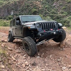 This is a two-trail run, Schenbly Hill Road in the morning followed by Broken Arrow for the afternoon. You do not have to run Broken Arrow in order to join us for Schenbly Hill Road. Schenbly Hill Rd is a scenic drive from I-17 down into Sedona with spectacular views looking down into and across Sedona and if we are lucky we may still catch some of the remaining high elevation fall color. When & Where: Saturday: November 1, 2025 @ 9:30 am Depart on the trail no later than 10:00 am Location: Schnebly Hill Rd Exit 320 (west side), I-17 (Google Maps Link) Nearest Gas Station: is just north of the Schnebly Hill exit. Munds Park Chevron off I-17, exit 322 (Google Maps Link) Trail Rating: Easy / Moderate Schnebly Hill road is rough but can be navigated easily with any reasonable clearance trail-rated SUV/CUV. Broken Arrow is a solid moderate for the major non-optional obstacle, the Devil's Staircase. Vehicle Requirements: Both Trails Front and rear recovery rated tow points Aggressive A/T or M/T tires are required Means to deflate and reinflate your tires Schnebly Hill Rd ( easy ) High clearance 4x4 or AWD vehicle designed for trail High in this case means at least 8+ inches of clearance. AWD "sport" CUV need to be their trail rated or trail enhanced trims Broken Arrow ( moderate ) High clearance, 4x4 with low range Lockers optional Full size vehicles are not recommended although if you really want to run with one, reach out to me and we'll discuss Aggressive A/T or M/T tires are required At least 33", 35 or larger recommended Communications: GMRS Channel 17 (462.600mhz). We may change GMRS channels as needed to avoid busy local repeaters or other nearby groups. Additional Considerations: Dress for the weather, Sedona in November can be chilly in the mornings Bring a chair! Bring a lunch, snacks, and plenty of water Recovery gear / traction aids Emergency supplies / Med kit Sunscreen! Don't forget that camera - you're going to want it Bring a positive attitude! Sign-Up/RSVP: There is a limit of 9 vehicles. Don't worry if you end up on standby; people drop out as plans change and you very likely will end up getting a spot! As part of your sign-up, please let me know the type of vehicle and if you intend to run both trails on only Schnebly Hill Rd. Attending: 1 @SonoranWanderer 2 @David P both trails 3 @Our Time to Explore both trails 4 @Mick Bowers both trails 5 @Gerald both trails 6 @Micely Broken Arrow 7 @Black goat both trails 8 @Bitshuffler both trails 9 @Jason Baker both trails Standby: 1 2 3 4 Headline picture from a 2024. Lower pictures from 2018.
-
Schnebly Hill Rd & Broken Arrow | 4x4 Easy / Moderate | Day Trip | Sedona
SonoranWanderer posted a calendar event in Community Calendar
This is a two-trail run, Schenbly Hill Road in the morning followed by Broken Arrow for the afternoon. You do not have to run Broken Arrow in order to join us for Schenbly Hill Road. Schenbly Hill Rd is a scenic drive from I-17 down into Sedona with spectacular views looking down into and across Sedona and if we are lucky we may still catch some of the remaining high elevation fall color. Open to anyone: Click here for full details & sign-up... -
By request since a few people were not able to make the Gala Cinders run, here is another chance for you to bag the high altitude awesome views and have a little fun in Double Crater. The Cinders OHV is a wide area of "crushed" volcanic rock with a wide range of elevation with many opportunities for vehicular recreation and awesome 360 degree views of the Arizona high country. Our route will provide some time for optional playing in the Double Bowl Crater. When & Where: Saturday: October 25, 2025 @ 9:30 am Depart for the Cinders OHV no later than 10:00 am Location: Flagstaff Chevron at 11230 US-89, Flagstaff, AZ 86004 (Google Maps Link) Trail Rating: Moderate Moderate mostly because of the soft surface and steep inclines that are not optional. Vehicle Requirements: High clearance, 4x4 with low range Lockers optional Depending on moisture level in the Cinders, lockers might be helpful for open diff vehicles who want to climb the fun way out of the bowl Aggressive A/T or M/T tires are required At least 33", 35 or larger recommended Means to deflate and reinflate your tires Front and rear recovery rated tow points Communications: GMRS Channel 17 (462.600mhz). We may change GMRS channels as needed to avoid busy local repeaters or other nearby groups. Additional Considerations: Dress for the weather, Flagstaff in late October can be chilly Bring a chair! Bring a lunch, snacks, and plenty of water Recovery gear / traction aids Emergency supplies / Med kit Sunscreen! Don't forget that camera - you're going to want it Bring a positive attitude! Sign-Up/RSVP: There is a limit of 8 vehicles. Don't worry if you end up on standby; people drop out as plans change and you may end up getting a spot! Attending: 1 @SonoranWanderer 2 @Mick Bowers 3 Mick's guest 4 @David P 5 @Dan.K 6 @Our Time to Explore 7 8 Standby: 1 2 3
-
DATE CHANGE: I have moved this run to Saturday October 4th. Fall is approaching and leaves are starting to turn colors. Join me for an mostly easy run through Cherry Creek, up the southwest side of the Black Mountains and down Mingus mountain. Beautiful scenery and spectacular views await. We will tackle approximately 40 miles of winding mountain trails. There will be a wide range of central Arizona mountain scenery throughout this trip When & Where: Saturday: October 4, 2025 @ 9:30 am Depart for the trail no later than 10:00 am Location: Yavapai Apache Market, 3400 AZ-260, Camp Verde, AZ 86322 (Google Maps Link) Trail Rating: Easy-ish I'm rating this 4 of 10, a hair over "easy" because of once section of FS413 that is pretty rough and AWS "sport" vehicles such as the Bronco Sport or Jeep Compass may need a little spotting. See photos in the first comment following this post. Vehicle Requirements: High clearance 4x4 or AWD vehicle designed for trail High in this case means at least 8+ inches of clearance. 12 is better. AWD "sport" CUV need to be their trail rated or trail enhanced trims Aggressive A/T or M/T tires are required Means to deflate and reinflate your tires Front and rear recovery rated tow points Communications: GMRS Channel 17 (462.600mhz). We may change GMRS channels as needed to avoid busy local repeaters or other nearby groups. Additional Considerations: Dress for the weather, It is not cold yet in Cottonwood, but we will be as high as 7500 feet in elevation for parts of the run. Bring a chair! Bring a lunch, snacks, and plenty of water Recovery gear / traction aids Emergency supplies / Med kit Sunscreen! Don't forget that camera - you're going to want it I Recommend you bring binoculars too! Bring a positive attitude! Sign-Up/RSVP: There is a limit of 8 vehicles. Don't worry if you end up on standby; people drop out as plans change and you may end up getting a spot! Attending: 1 @SonoranWanderer 2 @David P 3 @CJ81 4 @Curly 5 @tkwak 6 7 8 Standby: 1 2 3
-
NEW DATE: Saturday 3/8/2025 Join me on a difficult trail up to an overlook of Lake Pleasant and the surrounding area. We'll climb a steep, boulder strewn, narrow trail to over 3,300ft for the view. Next we'll loop down into a rocky creek bed to check out a well preserved old miner's homestead. Finally we'll exit back toward Castle Hot Springs road to air-up at the original meetup spot. I've tagged this "exploratory" because it's been several years since i did the entire loop - we could encounter washouts or boulders requiring us to take alternate routes - be ready to roll with it! Click here for details & to sign-up... Please note this is an Offroad Passport Club members-only event. View membership options →
-
Join me on a day trip for an interesting, fun ride in the Signal Mountain and Woolsey Peak Wilderness. We will air down near the interesting old town of Arlington, AZ then work our way west between the volcanic mountains over washes and rolling hills. Time permitting we’ll extend the ride to the amazing overlook at the Gillespie Dam Bridge. Should be a relaxing ride through some beautiful volcanic terrain and air up at the striking cliff overlook of a dam and 10 span iron bridge. To sign up click HERE For questions call or text Mick Bowers 623-432-2895 Please note this is an Offroad Passport Club members-only event. View membership options →
-
- 2
-
-
- signal mtn
- day run
- (and 1 more)
-
[CLUB] Asbestos Mine Trail (Again)| Near Lake Roosevelt, AZ | 4x4 Moderate
theksmith posted a calendar event in Community Calendar
DATE CHANGED FROM SATURDAY 5/20 to SUNDAY 5/21! Join us for a challenging climb up to an incredible scenic overlook and abandoned asbestos mine. This moderate rated trail runs through a burned area and is therefore prone to washouts, large eroded ditches, and inconveniently placed boulders and downed trees. It's also extremely narrow in places, so no full-size rigs please. Note: This is our second 2023 run on this trail, members that were on the standby list for the first trip have sign-up priority for this one. Click here for the trip report from our last attempt... Details & sign-up click here... Please note this is an Offroad Passport Club members-only event. View membership options → -
[CLUB] Crapshoot Trail Wildflower Run | Near New River, AZ | 4x4 Moderate
theksmith posted a calendar event in Community Calendar
Join me for a short day run on the moderate 4x4 trail "Crapshoot" in the Table Mesa area. This loop should make for some great views of the current spring bloom. Most stock high-clearance 4x4's with a low-range option on the transfer case can make this trail, though sway-bar disconnects and a small lift are recommended and will make things much easier. Total newbies may be intimidated by some of the steep loose climbs and small ledges, but folks with even a little experience on moderate trails should be fine. Click here for details or to sign-up... Please note this is an Offroad Passport Club members-only event. View membership options → -
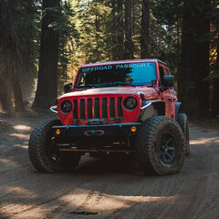
[Club] Backway to Crown King | Near Lake Pleasant, AZ | Moderate 4x4
4x4tographer posted a calendar event in Community Calendar
Join me for a day run up the iconic Backway to Crown King, a Jeep Badge of Honor trail and local favorite. We'll spend 5-6 glorious hours on the trail, including lunch, and stop for a drink and/or meal in the famous town of Crown King! Trail Difficulty: Moderate to Difficult - This trail "changes" all of the time depending upon wear/weather. There are multiple (7) obstacles, all but 1 (to my knowledge) have a bypass. The obstacles range from mild to wild, making this the ultimate "choose your own adventure" trail in the Valley. Click here for details & to RSVP... Please note this is an Offroad Passport Club members-only event. View membership options → -
**NEW DATE** [Club] Box Canyon | Near Florence, AZ | Moderate 4x4
4x4tographer posted a calendar event in Community Calendar
Join us for a fun run through Box Canyon in Florence, AZ (not to be confused with Box Canyon in Wickenburg). Box Canyon is the highlight of this trail ride providing southern access to the popular trail system just north of Box Canyon and Florence, Arizona commonly referred to as, "Florence Junction." Driving through Box Canyon is a wonderful scenic introduction to the area and is a very popular trail. Click here for details & to RSVP... Please note this is an Offroad Passport Club members-only event. View membership options → -
[Club] Asbestos/Zimmerman Point Day Run | Near Lake Roosevelt, AZ | Moderate 4x4
theksmith posted a calendar event in Community Calendar
Join us for a moderately challenging climb up to an incredible scenic overlook and abandoned asbestos mine. The trail runs through a burned area and is therefore prone to washouts, large eroded ditches, and inconveniently placed boulders and downed trees. Click here for details & to RSVP... Please note this is an Offroad Passport Club members-only event. View membership options → -
 untilIt's time for Offroad Passport's Annual Holiday party after the Holidays! Join us for an easy trail ride and big time fun with your Offroad Passport friends! We'll be grilling burgers & dogs for a potluck lunch, plus there's the infamous cut-throat white elephant gift game, kids gift exchange, and the annual cookie contest (and judging, yummy)! We're at a new location again this year with an easy desert trail ride to see some neat mining ruins before the party starts! Open to Everyone: Details and sign-up thread here...
-

Mogollon Rim- 7-16-22 - Easy To Moderate
shellback91 posted a topic in Trip & Event Planning/Sign-up
Mogollon Rim- 7-16-22 - Easy To Moderate My wife and I will be in Payson 7-15 through 7-17 escaping the summer heat. She is not a camping person so we are staying at a hotel in town. There are camping spots all over up there if you want to camp Friday(7-15) or Saturday night or both nights. My plan is to run a few easy Mogollon Rim trails on 7-16 while we are up there. I want to revisit the area and check out some cabins, one of which is a short hike off one of the trails. If my math is correct we are looking at about 60 miles total. These are mainly easy trails where, based on prior experience, we can make good time. Here's the trails I have mapped out. Rim Road- I am starting on the East side off of HWY 260. This will be run West to the next trail. Cabin Loop Trail- We will run a good portion of this trail over to the next trail. FR 139G- We will run this short 2 mile trail south. Per TrailsOffroad there is an old homestead next to Aspen Spring that is worth checking out. They say the hike is easy and less than a 1/2 mile(one way) off this trail. Dick Hart Ridge- The previous trail ends here so we will continue south until this trail ends at Rim Road(FR 300) Rim Road- We will run this West to HWY 87 from where Dick Hart Ridge ends. . Meet-Up & Departure: Time: 0830 at the Rim Road trailhead off of Hwy 260. (Old Rim Road Visitor Center) There is an area there for all of us to stage up and air down. If folks want to meet 30 minutes earlier I am open to that as well. Depart NLT 0900 Google Map here. No service stations near by, recommend to top off off in or around Payson on the way in. ADDITIONAL INFORMATION This trip is subject to cancellation or postponement due to rain, fire, inclement weather or $10 a gallon gas.🤣 Communications: GMRS - Channel 20 (462.675 MHz) Other Considerations: Plenty Of Water & Food (pack a lunch and snacks!) Dress for the weather. Folding chairs Sunscreen Camera Emergency supplies / Med Kit No facilities, plan accordingly DRIVER & VEHICLE REQUIREMENTS This trail is suitable for beginner for 4x4 enthusiasts. Be advised there is a good mix of terrain including but not limited to some mild off camber sections and loose rock in various spots. Vehicle Minimums: All vehicles are required to meet state legal requirements, (i.e.: current registration and insurance) Each vehicle must have a GMRS or HAM Radio in good working order Have functional seat-belts for each occupant Must have suitable recovery points front and rear High-clearance 4x4's with low-range 30"+ aggressive all-terrain or mud-terrain tires SIGN-UPS Post a reply in this thread saying you'd like to go and I'll put you on the roster! I am setting it at 10 including me for now. Once the limit is reached, anyone asking to sign-up will be placed on the standby list. Please don't hesitate to sign-up as a standby because people often do drop-out so you may get to still go. @shellback91 & Mrs. shellback91 @Large_Marge @Ken Ford @ZR2-Ben @English Al @Jbjr Standby -
[Club] Dripping Springs Day Run | near Quartzsite, AZ | Moderate 4x4
theksmith posted a calendar event in Community Calendar
Natural springs in the low desert, petroglyphs, stone cabins, narrow canyons, and beautiful views - how much more could you pack into a single day run! Details and RSVP here... Please note this is an Offroad Passport Club members-only event. View membership options → -
[Club] Cherry Creek Trail Day Run | near Young, AZ | Difficult 4x4
4x4tographer posted a calendar event in Community Calendar
Cherry Creek is a 41 mile run through the Sierra Anchas that spans a range of geographies from mountain pine to low desert. This trip is considered a bit of a swan song for the trail as it is slated to be closed by the Forest Service via their recent Travel Management Plan. We have a short span of time where running the trail is still allowed. Details & RSVP Here (repost)... Please note this is an Offroad Passport Club members-only event. View membership options → TRAIL DIFFICULTY: Exploratory Experience driving difficult trails recommended. Trail gains its rating for the following reasons: Off camber: mild to extreme Possible high water crossings Narrow shelf roads Trail/switchback washouts guaranteed Potential for body damage Vehicle Minimums: All vehicles are required to meet state legal requirements, (i.e.: current registration and insurance) & have functional seat-belts for each occupant Must have suitable recovery points front and rear Rock sliders/rocker protection Skid plate protection of important components Flexy suspension with sway bar disconnects High-clearance 4x4 with low-range 33"+ aggressive all-terrain or mud-terrain tire Each vehicle must have a GMRS or Ham Radio in good working order Vehicle Recommendations: Winch, aftermarket differential covers, high-clearance metal bumpers, low axle gearing, 4:1 transfer case, 35"+ tires. Spare fuel if you have a thirsty rig (trail is only 40 miles, but there is only 1 shot at refueling in Roosevelt before you hit a long, dead stretch of highway home). Driver Requirements: Experience on difficult trails is a plus A cool head and a positive attitude -
untilRed Creek is an amazing hidden desert oasis only about 90 minutes from Cave Creek, AZ. Join us on this unique moderately difficult 4x4 trail that runs right through the creek. We'll tent camp where the the canyon collides with the Verde River, enjoying the relaxing sounds of running water and the beauty of several large oak trees. After leisurely breaking camp the next morning, we'll travel the same route in reverse to exit. Full details & RSVP here... Please note this is an Offroad Passport Club members-only event. View membership options →
-
It's time for Offroad Passport's Annual Holiday party after the Holidays! Join us for an easy trail ride and big time fun with your Offroad Passport friends! We'll be grilling burgers & dogs for a potluck lunch, plus there's the infamous cut-throat white elephant gift game, kids gift exchange, and the annual cookie contest (and judging, yummy)! We're at a new location again this year with an easy desert trail ride to see some neat mining ruins before the party starts! Open to Everyone: Details and sign-up thread here...
-
March Madness Multiple Day Runs | near Kingman, AZ | Difficult 4x4
dzJeepChic posted a calendar event in Community Calendar
untilFull details & and sign-up link coming soon! -
[Club] Black Friday Post-Turkey Workout | near Cleator, AZ | 4x4 Moderate
4x4tographer posted a calendar event in Community Calendar
Join me on Black Friday to work off those turkey-induced comas with a little core-training on Turkey Creek, just north of Phoenix near Bumble Bee! We'll enjoy some fall color (I hope), the cooler weather, and some nice scenery. Click here for details & to sign-up... Note this is an Offroad Passport Club members-only event. View membership options → -
[Club] Big Spring Wash | near Lake Pleasant, AZ | 4x4 Difficult
theksmith posted a calendar event in Community Calendar
Get some trail therapy on Saturday to recover from all the Black Friday chaos with a super fun "light difficult" day run - just enough challenge to keep you awake and entertained. This run has nice low desert scenery, really neat rock formations, and wildlife sightings (burros, javelina, fox). Click here for details & to sign-up... Note this is an Offroad Passport Club members-only event. View membership options → -
Sorry about the last minute post! We decided to do some maintenance at John desert4x4's memorial before we move in a couple months. This is a run is Sunday, May 2, on Sunflower Mine Trail, but not the loop down in the creek. We're going in/out the moderate way in and out, not the difficult loop through the creek. I'm taking container, and I got some note pads and stuff. We'll do some clean up around the site, trim the bushes and just check on things in general, and have lunch there. Returning the same way we went in. Meet up: 9:30 AM @ Ba'ja Gas Station/Chevron Map Here... (FYI I recommend you fuel up elsewhere as Ba'ja is pricey!) What to Bring: Plenty of water, lunch, snacks, sun-screen, hat, sunglasses, camera, usual trail gear i.e. tools, etc. Trail Conditions & Rig Minimums: The trail is rated moderate due to a few rocky ascents and descents, but is otherwise easy. It is suitable for high-clearance 4x4's with low-range and aggressive all-terrain or mud-terrain tires. Must have suitable recovery points front and rear and CB or Ham Radio in good working order. Trail Leaders: @dzJeepChic & @Number7 Attending:
- 13 replies
-
- 1
-

-
- 4x4 moderate
- day run
- (and 3 more)
-
Sunflower Mine Trail - desert4x4 Memorial Maint, Near Fountain Hills, 4x4 Moderate
dzJeepChic posted a calendar event in Community Calendar
We decided to do some maintenance at John desert4x4's memorial before we move in a couple months. This is a run is Sunday, May 2, on Sunflower Mine Trail, but not the loop down in the creek. We're going in/out the moderate way in and out, not the difficult loop through the creek. I'm taking container, and I got some note pads and stuff. We'll do some clean up around the site, trim the bushes and just check on things in general, and have lunch there. Returning the same way we went in. Sign up and more info here...


-
Welcome! Please enjoy the site but note that you'll need a membership to access some features and content.