
Search the Community
Showing results for tags 'scenic'.
Found 51 results
-
untilJoin us for a multi day trip in the San Rafael Swell. We will stay in Green River, UT, so anyone, who is interested can come at any day and stay as long as he/she wants. It is a nice weather trip. Event details & sign-up are on Facebook: Click here for the San Rafael Swell event... Note: This event is shared and being led by ORP member @ChrisD. This is open to anyone - you do not have to be an Offroad Passport Club member to sign-up.
-

[CLUB] Dupont Cabin & Cave | near Punkin Center, AZ | 4x4 Moderate
theksmith posted a calendar event in Community Calendar
Join us on a moderate rated loop up into the Sierra Anchas (to over 5,000ft elevation). We'll visit the well known Dupont Cabin and a semi-secret tiny cave while taking in the stellar views of Tonto Basin down below. Plan for a lunch stop in the shady pines (i.e. bring food and a chair)! The trail is primarily easy forest roads with a few rocky washes to cross where skid plates might be needed. One long steep descent with loose rocky terrain gives this trail its moderate rating. This run should be doable by many stock high-clearance 4x4s (Wranglers, Broncos, Tacomas, etc.) Click here for details and to sign-up... Note this is an Offroad Passport Club members-only event. View membership options → -
We'll head out East US 60 towards Superior, and cut south on Highway 177 for a short distance. From there, we will cross desert land before heading east down/up Cottonwood Canyon. We'll continue east, through this pretty area, a small section of shelf road, have lunch at the remnants of the old Ajax Mine. Then head east more, and finally north around Picketpost Mountain through Telegraph Canyon. We end up in Superior. Difficulty: It was a moderate trail, due to sandy washes and a shelf road, so I expect the same...but don't hold me to it! I do not expect this to be difficult. That being said, be sure you have good off-road tires, tow points, and all that stuff. Mini-vans are not accepted. Have some ground clearance. Click here for details and sign up...
-
- 2
-

-
- day run
- 4x4 moderate
- (and 3 more)
-
untilThe Dusy-Ershim is an extremely difficult and beautiful 4x4 trail located in the middle-of-nowhere portion of the Sierra National Forest in California. It's often compared to The Rubicon Trail with similar granite slabs, towering pines and scenic small lakes. However, most folks agree that the current trail conditions, remoteness, and 33 mile length make for a more extreme adventure. The entire trail is higher elevation as well (9 to 10k feet). That means an even shorter wheeling season of Aug 1 through Nov 1 depending on snowpack. This challenging overland adventure will entail rock-crawl style wheeling for 4 days with primitive tent camping by the trail each night. The dates listed are actual trail days. Plan at least one additional day on each end for travel to/from the Shaver Lake area (11+ hours from Phoenix). Dates could shift depending on weather or wildfires, our backup trip dates are 9/25 - 9/28/2026. This is not a typical ORP event - there are strict rig & driver requirements! Any sign-ups are pending approval from the trip leader. Rig Requirements: Street-legal rigs only Absolute tip-top mechanical condition rigs with no recent un-tested mods! Minimum tire sizes: 2-door Wranglers: 35's, 4-door Wranglers: 37's, Gladiators: 40's Front & rear axle lockers Alloy axle shafts or a full set of spares An extremely flexy suspension lift & sway bar disconnects Full skid plates & rock rail coverage A winch Suitable solid mounted front & rear tow points A full size spare tire in good shape (or multiple Glue Tread kits if you're running bigger than 40's and all other tires in good shape) High clearance bumpers and fender flares strongly recommended but not required Driver Requirements: Highly experienced drivers well versed in extreme rock crawling trails Must be able to pick your own lines from the driver's seat. There's simply no way to pre-walk every obstacle or spot everyone constantly. Basic mechanical knowledge/skills and capability to work on your own rig. Know-how and experience changing u-joints and axle shafts. Experience with and ability to perform self-recovery (winching, setting up rigging, etc.). Other Requirements: Extra securely/safely mounted fuel! Most modern rigs need an extra 5 gallons of gas to complete the trail and make it back to civilization/gas (Shaver Lake). If you have a thirsty rig you may need even more. Basic recovery items including gloves, a tree strap and multiple shackles - extra recovery gear is a plus (snatch blocks, extra straps, winch extensions, shovel, traction boards, etc.). Basic tools and common spare parts such as u-joints for driveshafts and axle. Spare fluids. All your dry camping stuff (tents, sleeping stuff, etc.) and kitchen/food stuff. Ability to setup your own camp and prepare your own food. A GMRS radio. Click here for details or to sign-up... Please note this is an Offroad Passport Club members-only event. View membership options →
-
 Near Bumble Bee Ranch, the scenic Turkey Creek Trail winds like a rollercoaster above and through several canyons, including Black Canyon, Dead Cow Gulch, and Turkey Creek Canyon. Along the way, you encounter very narrow ledge roads, boulder-strewn washes and an abundance of tight desert brush. It is highly recommended to have larger tires and skid plates, especially if the creek beds are running with water. Sections of the trail may require a spotter and careful tire placement, especially at the short narrow ledge obstacle (see photo). Fantastic views, rocky terrain, and multiple water crossings await those adventurous enough to take the long way to the unique Cleator Bar and Yacht Club. Not recommended for full-size trucks. Check out these links for additional info: Turkey Creek Trail Cleator, Arizona | GPS Map, Photos & Reviews Turkey Creek - FunTreks VEHICLE/DRIVER REQUIREMENTS · 4x4, low range recommended · Rear locker recommended but not required · 2” or larger lift · 33" or larger aggressive A/T or M/T tires · Skid plates and rock rails are always a good idea. · GMRS radio required · Newbies will be challenged CLICK HERE TO SIGN UP
-
Join us on a short moderate rated night run on a portion of the Hieroglyphic Mountain Loop in the Boulders OHV area. We'll eventually connect to Morgan City Wash for a bit, then exit onto the paved part of Castle Hot Springs road near Lake Pleasant & Hwy 74. Should be a 3 to 4 hour run depending on group size. This trail is probably OK for newbies as long as you are comfortable with some steep climbs and descents in the dark! Family friendly and no drinking and driving! General requirements: A high clearance, street legal, 4x4 with low range t-case option. Skid plates on anything important. No low hanging side steps, front air-dams, etc. For example, most stock 4wd Wranglers, Broncos, and Tacomas are likely good but other rigs may need a small lift. Click here for Details & to RSVP... Note this is an Offroad Passport Club members-only event. View membership options →
-
[CLUB] The Rug Road | near Mammoth, AZ | 4x4 Difficult | Dispersed (Tent) Camping
theksmith posted a calendar event in Community Calendar
untilAbandoned buildings, cliff dwellings, Coatimundi, mining ruins, a famously steep bouldery hill, beautiful scenery, and a lush river canyon in the desert - all in one trip! Join us for an overnighter as we run Arizona's neatest overland route, the historic Rug Road. We'll take it in reverse (from Mammoth to Klondyke), which is considered the easier direction as that takes us down the infamous Carpet Hill instead of having to climb it. We'll meet up early Saturday morning in Mammoth then get started on the rougher part of the trail up to about the half way point where we'll make camp. Then Sunday we'll continue our way on the easier half, exiting through the lush Aravaipa Canyon into Klondyke, AZ. Note that if you're headed back to Phoenix, it may be dark when you get home (Klondyke is 4 hours away). General requirements (see the sign-up thread for full details): A high clearance 4x4 with a low-range t-case option (i.e. 4-low), 33"+ aggressive tires, a 1.5"+ suspension lift, full skid plate coverage, rock rails No trailers on this run. Full-size vehicles strongly discouraged. Click here for full details and to sign-up... Note this is an Offroad Passport Club members-only event. View membership options → -
[CLUB] Saturday 03/21/2026 | Sunflower Mine | Day Run | 4X4 • Difficult/Extreme
Michael Trapschuh posted a calendar event in Community Calendar
The Sunflower Mine Trail presents a demanding route for Jeep enthusiasts, leading to the site of an abandoned mercury mine nestled in the rugged Mazatzal Mountains between Mesa and Payson. The journey begins with a moderate section, as the trail winds through a lush and rocky canyon toward the mine itself. Upon reaching the mining area, explorers can view the remnants of the operation, which include several ruins and a massive trommel left behind from the site's active days. After taking time to explore these historic features, the adventure continues as the trail ascends further up the canyon. The level of difficulty increases significantly at this point. Drivers must navigate over large boulders scattered throughout the narrowing canyon. Progressing through this challenging stretch, the canyon constricts, eventually presenting a relatively steep climb. This ascent requires vehicles to climb up and over a ledge, after which the trail transitions briefly to a rutted shelf road and ultimately exits onto the forest service road, Check out these links for additional info: Sunflower Mine - FunTreks Sunflower Mine Loop, Arizona | Trails Offroad VEHICLE/DRIVER REQUIREMENTS · Shorter wheel bases advised · 4x4, low range · Front + Rear lockers · 3” or larger lift · 35" or larger aggressive A/T or M/T tires · Skid plates and rock rails · GMRS radio required · Winch and recovery accessories CLICK HERE TO SIGN UP... -
This is a 50-mile point to point (30m graded dirt, 10m sandy wash, 10m rocky shelf road) just outside of downtown Wickenburg (Hwy 60 approx. 30 miles west of 303) and ends up near Morristown at the Hwy 67/60 intersection. A fun trail with a 5869 ft elevation gain that includes a couple of technical descents, scenic mountain views and some high canyon walls in the washes. Very challenging for small lift and slightly larger than stock tires. This is an approx. 6+ hour run, so pack lunch, snacks and plenty of water. Maybe plan for an early dinner in Wickenburg. Check out these links for additional info: Explore Wickenburg Mountain OHV Trail | AllTrails Wickenburg Mountains - FunTreks VEHICLE/DRIVER REQUIREMENTS · 4x4, low range recommended · Rear locker recommended but not required · 2” or larger lift · 33" or larger aggressive A/T or M/T tires · Skid plates and rock rails are always a good idea. · GMRS radio required · Newbies will be challenged CLICK HERE TO SIGN UP
-

[CLUB] KOFA Overland Run | Near Quartzsite, AZ | Moderate 4x4 | Primitive Camping
shellback91 posted a calendar event in Community Calendar
untilJoin me for 3 days and 2 nights of exploration in the KOFA Wildlife Refuge on this overland style run. This run will take us through some amazing parts of the KOFA National Wildlife Refuge. We'll wind up at the Hovatter homestead Saturday night then head north to the I-10 on Sunday. This scenic area is known for wildlife, old mines & cabins from the area's mining glory days. Due the trail conditions in a few spots no full sized rigs or trailers on this run. Safety is the most important thing. You can message me with any questions related to this. Requirements A high clearance 4x4 rig with a low range transfer case option, suitable front & rear recovery point, aggressive A/T or M/T tires While not required, aftermarket skid plates, rock rails, and sway-bar disconnects are recommended. Rigs & drivers must meet all the typical state/federal legal requirements for on-highway vehicles (license, insurance, registration, seat belts, lights, etc.) Vehicle should be mechanically sound and safe to drive Recovery gear, first aid kit, fire extinguisher Drivers of varying experience should be fine on this trip A great attitude! 🙂 Details and sign ups can be found here. Note this is an Offroad Passport Club members-only event. View membership options → -
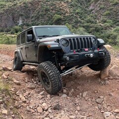 This is a two-trail run, Schenbly Hill Road in the morning followed by Broken Arrow for the afternoon. You do not have to run Broken Arrow in order to join us for Schenbly Hill Road. Schenbly Hill Rd is a scenic drive from I-17 down into Sedona with spectacular views looking down into and across Sedona and if we are lucky we may still catch some of the remaining high elevation fall color. When & Where: Saturday: November 1, 2025 @ 9:30 am Depart on the trail no later than 10:00 am Location: Schnebly Hill Rd Exit 320 (west side), I-17 (Google Maps Link) Nearest Gas Station: is just north of the Schnebly Hill exit. Munds Park Chevron off I-17, exit 322 (Google Maps Link) Trail Rating: Easy / Moderate Schnebly Hill road is rough but can be navigated easily with any reasonable clearance trail-rated SUV/CUV. Broken Arrow is a solid moderate for the major non-optional obstacle, the Devil's Staircase. Vehicle Requirements: Both Trails Front and rear recovery rated tow points Aggressive A/T or M/T tires are required Means to deflate and reinflate your tires Schnebly Hill Rd ( easy ) High clearance 4x4 or AWD vehicle designed for trail High in this case means at least 8+ inches of clearance. AWD "sport" CUV need to be their trail rated or trail enhanced trims Broken Arrow ( moderate ) High clearance, 4x4 with low range Lockers optional Full size vehicles are not recommended although if you really want to run with one, reach out to me and we'll discuss Aggressive A/T or M/T tires are required At least 33", 35 or larger recommended Communications: GMRS Channel 17 (462.600mhz). We may change GMRS channels as needed to avoid busy local repeaters or other nearby groups. Additional Considerations: Dress for the weather, Sedona in November can be chilly in the mornings Bring a chair! Bring a lunch, snacks, and plenty of water Recovery gear / traction aids Emergency supplies / Med kit Sunscreen! Don't forget that camera - you're going to want it Bring a positive attitude! Sign-Up/RSVP: There is a limit of 9 vehicles. Don't worry if you end up on standby; people drop out as plans change and you very likely will end up getting a spot! As part of your sign-up, please let me know the type of vehicle and if you intend to run both trails on only Schnebly Hill Rd. Attending: 1 @SonoranWanderer 2 @David P both trails 3 @Our Time to Explore both trails 4 @Mick Bowers both trails 5 @Gerald both trails 6 @Micely Broken Arrow 7 @Black goat both trails 8 @Bitshuffler both trails 9 @Jason Baker both trails Standby: 1 2 3 4 Headline picture from a 2024. Lower pictures from 2018.
-
Schnebly Hill Rd & Broken Arrow | 4x4 Easy / Moderate | Day Trip | Sedona
SonoranWanderer posted a calendar event in Community Calendar
This is a two-trail run, Schenbly Hill Road in the morning followed by Broken Arrow for the afternoon. You do not have to run Broken Arrow in order to join us for Schenbly Hill Road. Schenbly Hill Rd is a scenic drive from I-17 down into Sedona with spectacular views looking down into and across Sedona and if we are lucky we may still catch some of the remaining high elevation fall color. Open to anyone: Click here for full details & sign-up... -
By request since a few people were not able to make the Gala Cinders run, here is another chance for you to bag the high altitude awesome views and have a little fun in Double Crater. The Cinders OHV is a wide area of "crushed" volcanic rock with a wide range of elevation with many opportunities for vehicular recreation and awesome 360 degree views of the Arizona high country. Our route will provide some time for optional playing in the Double Bowl Crater. When & Where: Saturday: October 25, 2025 @ 9:30 am Depart for the Cinders OHV no later than 10:00 am Location: Flagstaff Chevron at 11230 US-89, Flagstaff, AZ 86004 (Google Maps Link) Trail Rating: Moderate Moderate mostly because of the soft surface and steep inclines that are not optional. Vehicle Requirements: High clearance, 4x4 with low range Lockers optional Depending on moisture level in the Cinders, lockers might be helpful for open diff vehicles who want to climb the fun way out of the bowl Aggressive A/T or M/T tires are required At least 33", 35 or larger recommended Means to deflate and reinflate your tires Front and rear recovery rated tow points Communications: GMRS Channel 17 (462.600mhz). We may change GMRS channels as needed to avoid busy local repeaters or other nearby groups. Additional Considerations: Dress for the weather, Flagstaff in late October can be chilly Bring a chair! Bring a lunch, snacks, and plenty of water Recovery gear / traction aids Emergency supplies / Med kit Sunscreen! Don't forget that camera - you're going to want it Bring a positive attitude! Sign-Up/RSVP: There is a limit of 8 vehicles. Don't worry if you end up on standby; people drop out as plans change and you may end up getting a spot! Attending: 1 @SonoranWanderer 2 @Mick Bowers 3 Mick's guest 4 @David P 5 @Dan.K 6 @Our Time to Explore 7 8 Standby: 1 2 3
-
DATE CHANGE: I have moved this run to Saturday October 4th. Fall is approaching and leaves are starting to turn colors. Join me for an mostly easy run through Cherry Creek, up the southwest side of the Black Mountains and down Mingus mountain. Beautiful scenery and spectacular views await. We will tackle approximately 40 miles of winding mountain trails. There will be a wide range of central Arizona mountain scenery throughout this trip When & Where: Saturday: October 4, 2025 @ 9:30 am Depart for the trail no later than 10:00 am Location: Yavapai Apache Market, 3400 AZ-260, Camp Verde, AZ 86322 (Google Maps Link) Trail Rating: Easy-ish I'm rating this 4 of 10, a hair over "easy" because of once section of FS413 that is pretty rough and AWS "sport" vehicles such as the Bronco Sport or Jeep Compass may need a little spotting. See photos in the first comment following this post. Vehicle Requirements: High clearance 4x4 or AWD vehicle designed for trail High in this case means at least 8+ inches of clearance. 12 is better. AWD "sport" CUV need to be their trail rated or trail enhanced trims Aggressive A/T or M/T tires are required Means to deflate and reinflate your tires Front and rear recovery rated tow points Communications: GMRS Channel 17 (462.600mhz). We may change GMRS channels as needed to avoid busy local repeaters or other nearby groups. Additional Considerations: Dress for the weather, It is not cold yet in Cottonwood, but we will be as high as 7500 feet in elevation for parts of the run. Bring a chair! Bring a lunch, snacks, and plenty of water Recovery gear / traction aids Emergency supplies / Med kit Sunscreen! Don't forget that camera - you're going to want it I Recommend you bring binoculars too! Bring a positive attitude! Sign-Up/RSVP: There is a limit of 8 vehicles. Don't worry if you end up on standby; people drop out as plans change and you may end up getting a spot! Attending: 1 @SonoranWanderer 2 @David P 3 @CJ81 4 @Curly 5 @tkwak 6 7 8 Standby: 1 2 3
-
NEW DATE: Saturday 3/8/2025 Join me on a difficult trail up to an overlook of Lake Pleasant and the surrounding area. We'll climb a steep, boulder strewn, narrow trail to over 3,300ft for the view. Next we'll loop down into a rocky creek bed to check out a well preserved old miner's homestead. Finally we'll exit back toward Castle Hot Springs road to air-up at the original meetup spot. I've tagged this "exploratory" because it's been several years since i did the entire loop - we could encounter washouts or boulders requiring us to take alternate routes - be ready to roll with it! Click here for details & to sign-up... Please note this is an Offroad Passport Club members-only event. View membership options →
-
A small group and I just completed a Casner Mountain run. We had some warm but enjoyable weather all day. It was good to see some familiar faces and meet some members for the first time. I enjoyed teh day out and hop eevery one else did too. A big shout out to @MzPriss and Bill for tail-gunning, I appreciate it! Those in attendance were: @MzPriss @LaZorraRoja @Sputternutz @Dcoleaz The road to the Casner Mountain trail was pretty uneventful. Casner Mountain trail itself was a little different. The road to the gate was indicator of things to come. Lots of wash outs, ruts and pretty rocky to the gate. Along the way we were joined by a whole bunch of grasshoppers that made themselves known. They liked hanging out on my windshield and side windows, which wound up creeping my wife out. 🤣 The switchbacks on the way up are pretty chewed up, rocky and rutted in multiple places now. It was still a fun ride up to the top with views that were good indicators of teh elevation gains we were making. Because of the conditions I kept the pace a little slower and kept a better eye on the turns. Once at the top we stopped and took in the views, all of which are amazing. The ride along the ridge-backs that divide Sycamore Canyon on the west from the Red Rock Secret Mountain Wilderness on the east always has some spectacular views. We stopped along the way and took in the views directly across from Sycamore Point. Overall once we got up top the trail is in relatively good shape, nothing too challenging. Once we reached the end of Casner we meandered our way across FR 538 where we found a nice shady spot near Power Tank for lunch. We had lunch there while being serenaded by a herd of cows that were hanging out. After lunch we made our way out across multiple trails through various types of terrains finally taking FR 237 and ending at I-17 early in afternoon. Thanks again to those who joined us today!
- 3 replies
-
- 4
-
-

-
- scenic
- switchbacks
- (and 1 more)
-
untilCamp Verde To Mogollon Rim Overland Style Run Friday June 16th & Saturday June 17th Primitive Tent Camping | No Facilities Join me for 2 days and approximately 105 miles of exploration on this overland style run. This route will take us from Camp Verde to the Mogollon Rim where we will camp. I have pieced this together using various trails in the area. Most of these trails are easy to moderate based on my research, nothing too technical is involved. There some rocky two track sections mixed for good measure. Extra fuel is not necessarily required, however, if you have the ability to bring some it is worth considering doing so. Note this is an Offroad Passport Club members-only event. View membership options → Run details and sign ups can be found here.
-
- 2
-
-
- camping
- overlanding
- (and 13 more)
-
[CLUB] Asbestos Mine Trail (Again)| Near Lake Roosevelt, AZ | 4x4 Moderate
theksmith posted a calendar event in Community Calendar
DATE CHANGED FROM SATURDAY 5/20 to SUNDAY 5/21! Join us for a challenging climb up to an incredible scenic overlook and abandoned asbestos mine. This moderate rated trail runs through a burned area and is therefore prone to washouts, large eroded ditches, and inconveniently placed boulders and downed trees. It's also extremely narrow in places, so no full-size rigs please. Note: This is our second 2023 run on this trail, members that were on the standby list for the first trip have sign-up priority for this one. Click here for the trip report from our last attempt... Details & sign-up click here... Please note this is an Offroad Passport Club members-only event. View membership options → -
[CLUB] Crapshoot Trail Wildflower Run | Near New River, AZ | 4x4 Moderate
theksmith posted a calendar event in Community Calendar
Join me for a short day run on the moderate 4x4 trail "Crapshoot" in the Table Mesa area. This loop should make for some great views of the current spring bloom. Most stock high-clearance 4x4's with a low-range option on the transfer case can make this trail, though sway-bar disconnects and a small lift are recommended and will make things much easier. Total newbies may be intimidated by some of the steep loose climbs and small ledges, but folks with even a little experience on moderate trails should be fine. Click here for details or to sign-up... Please note this is an Offroad Passport Club members-only event. View membership options → -
untilWe are going to do some exploration around the Apache Maid and Cedar Flats trails. We will be camping on Saturday at the Buckhorn Cabin and ranch area. Planning on making it to make camp early in the afternoon so we can set up, explore the area and relax. I am putting trails and other stuff together soon. Details and sign-ups are available here...
-
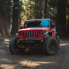
[Club] Backway to Crown King | Near Lake Pleasant, AZ | Moderate 4x4
4x4tographer posted a calendar event in Community Calendar
Join me for a day run up the iconic Backway to Crown King, a Jeep Badge of Honor trail and local favorite. We'll spend 5-6 glorious hours on the trail, including lunch, and stop for a drink and/or meal in the famous town of Crown King! Trail Difficulty: Moderate to Difficult - This trail "changes" all of the time depending upon wear/weather. There are multiple (7) obstacles, all but 1 (to my knowledge) have a bypass. The obstacles range from mild to wild, making this the ultimate "choose your own adventure" trail in the Valley. Click here for details & to RSVP... Please note this is an Offroad Passport Club members-only event. View membership options → -
**NEW DATE** [Club] Box Canyon | Near Florence, AZ | Moderate 4x4
4x4tographer posted a calendar event in Community Calendar
Join us for a fun run through Box Canyon in Florence, AZ (not to be confused with Box Canyon in Wickenburg). Box Canyon is the highlight of this trail ride providing southern access to the popular trail system just north of Box Canyon and Florence, Arizona commonly referred to as, "Florence Junction." Driving through Box Canyon is a wonderful scenic introduction to the area and is a very popular trail. Click here for details & to RSVP... Please note this is an Offroad Passport Club members-only event. View membership options → -

[Club] Baja Mexico Adventure | 4x4 Easy | Beach Camping and Hotels
dzJeepChic posted a calendar event in Community Calendar
untilWe are planning a 'fluid' trip to Baja Mexico lasting 10 to 14 days. The rough plan is to meet in San Felipe, then drive 2 or 3 days to Loreto, and spend a couple, 3 or 4 days checking out that area before making our way back. On the way home we are going to stop off at however many points of interest along the Sea of Cortez as we have time for. Details and Sign Up Here... Please note this is an Offroad Passport Club members-only event. View membership options → -
[Club] KOFA 2023 | Near Quartzite, AZ | Moderate 4x4
shellback91 posted a calendar event in Community Calendar
untilCome explore KOFA Wildlife Refuge for 3 days, 2 nights and approximately 125 miles(Actual Mileage TBD) of exploration on this overland style run. This run will take us through some amazing parts of the KOFA National Wildlife Refuge. We'll wind up at the Hovatter homestead Saturday night then head north to the I-10 on Sunday. This scenic area is known for wildlife and old mines & cabins from the mining glory days. Click here for details & to RSVP... Note this is an Offroad Passport Club members-only event. View membership options → -
[Club] Asbestos/Zimmerman Point Day Run | Near Lake Roosevelt, AZ | Moderate 4x4
theksmith posted a calendar event in Community Calendar
Join us for a moderately challenging climb up to an incredible scenic overlook and abandoned asbestos mine. The trail runs through a burned area and is therefore prone to washouts, large eroded ditches, and inconveniently placed boulders and downed trees. Click here for details & to RSVP... Please note this is an Offroad Passport Club members-only event. View membership options →


-
Welcome! Please enjoy the site but note that you'll need a membership to access some features and content.